|
May 15, 2008. I include the date because conditions may be significantly different in a year or even in six months. The lower part of this ride included a stretch of large gravel which was hard to pedal up and jarring on the way down. The next section featured pea-sized gravel that was easier but had its own problems because it was a bit loose. The gravel "features" persisted for the first mile and a half. After a few months of traffic the difficulty may abate.
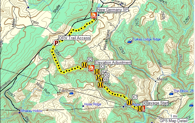
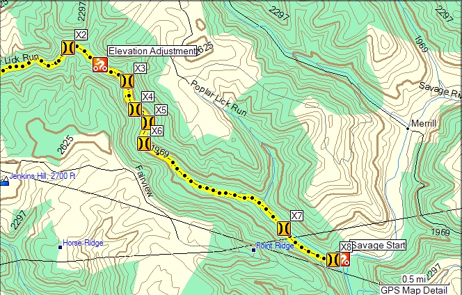
There are no fewer than eight stream crossings between the Savage River and New Germany State Park. If it's cold and there's water in the stream you should think about how you are going to manage getting your feet wet and riding too, perhaps some giant Wellington boots or fishing waders are in order. I was able to ride thru only two of the sixteen (eight up and eight back) crossings. The water was generally calf deep. Between the current and the loose rocks on the stream bed I could only make it one quarter or one third of the way before dismounting. On the way back down I screwed up my courage and rode across the two fords with paved bottoms.
Poplar Lick is a gorgeous stream and the ride up and back is as scenic as you could ask for. There are roadside campsites along the way with no facilities.
DeLorme Maryland : 66 B2
Topo Map
Vertical Profile
Google Map
Book References
Download POIs for Start and Finish and nearby Campground
Topo or Street Map

Crossing Detail Topo:

Vertical Profile

BookReference
 The Mountain Biker's Guide to Central Appalachia: West Virginia, Western Maryland, Pennsylvania, New York (Dennis Coello's America By Mountain Bike) (Paperback)
by Joe Surkiewicz (Author) The Mountain Biker's Guide to Central Appalachia: West Virginia, Western Maryland, Pennsylvania, New York (Dennis Coello's America By Mountain Bike) (Paperback)
by Joe Surkiewicz (Author)
If you found this useful please buy the book.
|


