|
Brief Description Here
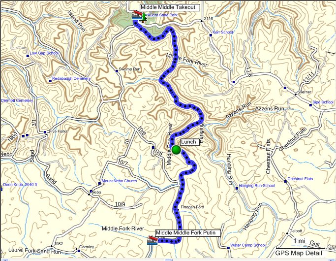
Go here for photos and another perspective using TopoFusion.
DeLorme West Virginia: 36 e5-f6
Topo Map
Vertical Profile
Google Map
Book References
Download POIs for Start and Finish and nearby Campground
Topo or Street Map

Vertical Profile

BookReference
My GPS
|
 |
Garmin Nuvi 350
A full-featured GPS system primarily for use in vehicles Includes pre-loaded maps and locations such as food, lodging, addresses.
I use this one to find the putins, takeouts and trailheads.
Read my complete review...
Buy one at Amazon.com.
|
 |
Garmin GPSMap 60CSx
A GPS system that's really useful for trails and streams. It can be used for highway navigation but I don't really reccomend it. It will lay down tracks, including elevation, for every place you go. You can easily mark waypoints (where you are right now).
This is the unit that produced all the tracks and waypoints that you see in this section of the website.
Buy one at Amazon.com. |
 |
Garmin Etrex Legend
I used to own one of these and replaced it with the 60CSx for a lot of reasons but primarily for the color screen that my aging eyes could read.
A great GPS unit primarily for hiking and biking. Will record tracks, ie, where you have been. Will help you get back if you get lost. Not suggested for road navigation but can be used for that.
Read my complete review...
Buy one at Amazon.com. |
Download MapSource.gdb
Download Fusion.gpx
|


